
Pulaski County ZIP Coverage
The official PAGIS addressing layer is the best countywide frame for a Pulaski County ZIP code directory. It contains 29 ZIP polygons and their postal cities. These are delivery areas, not a municipal map. The table keeps fringe and special cases visible so a postal label is never mistaken for proof of city or county jurisdiction.
| ZIP | Main Pulaski area | Postal context | Boundary note |
|---|---|---|---|
| 72002 | Alexander and southwest edge | Alexander | Crosses county lines |
| 72016 | Western rural fringe | Bigelow | County and city may differ |
| 72023 | Northeast fringe | Cabot | Also reaches Lonoke County |
| 72046 | Southeast fringe | England and Scott area | Extends beyond Pulaski |
| 72065 | South and southwest rural area | Hensley | Rural delivery area |
| 72076 | Jacksonville | Jacksonville | Main city delivery area |
| 72103 | Southwest county | Mabelvale | Little Rock and unincorporated addresses |
| 72113 | Maumelle and nearby county | Maumelle | City and county area |
| 72114 | Core and east-central North Little Rock | North Little Rock | Urban core |
| 72116 | North Little Rock and Sherwood | NLR and Sherwood | ZIP does not follow city line |
| 72117 | East North Little Rock and county | North Little Rock | Industrial and unincorporated areas |
| 72118 | Northwest North Little Rock | North Little Rock | Includes county pockets |
| 72120 | Sherwood | Sherwood | Reaches beyond city line |
| 72126 | West and northwest rural county | Roland | Rural polygon |
| 72135 | Roland and northwest Little Rock fringe | Roland | Rural and suburban |
| 72142 | Southeast agricultural area | Scott | County-edge coverage |
| 72201 | Downtown Little Rock | Little Rock | Government and business core |
| 72202 | Central and east Little Rock | Little Rock | Historic areas near downtown |
| 72204 | Southwest and central Little Rock | Little Rock | Broad city area |
| 72205 | Midtown Little Rock | Little Rock | ADH and UAMS vicinity |
| 72206 | South and east Little Rock | Little Rock | Crosses city boundary |
| 72207 | Heights and Pulaski Heights | Little Rock | Historic northwest-central area |
| 72209 | South and southwest Little Rock | Little Rock | City and edge areas |
| 72210 | West and southwest Little Rock | Little Rock | Developing county fringe |
| 72211 | West Little Rock | Little Rock | Suburban west |
| 72212 | Northwest Little Rock | Little Rock | Suburban northwest |
| 72223 | Far west Little Rock and county | Little Rock | Large city-edge mismatch |
| 72227 | West-central Little Rock | Little Rock | Compact suburban area |
| 72231 | Little Rock boxes | Little Rock | Special mailing use, not an ordinary residential polygon |
Codes found in agency mailing lists may not appear as normal residential polygons. Examples include 72078, 72099, 72115, 72119, 72124, 72164, 72180, 72183, 72190, 72203, and 72208. Some are box, unique, service, or legacy routes. Verify a real address rather than adding them to a resident count.
Read Pulaski County ZIP Geography
Pulaski County has a capital-city core split by the Arkansas River, several suburbs, and broad rural edges. Postal geography crosses those civic lines. A Little Rock mailing line can describe an unincorporated parcel. The 72116 area overlaps North Little Rock and Sherwood, while 72206 and 72223 cross obvious city-edge expectations. Outlying codes tied to Alexander, Cabot, Bigelow, and England may continue into neighboring counties.
The PAGIS ZIP data dictionary defines the local polygon and postal-city values. It supplies the defensible county domain, but USPS remains the delivery authority for one exact mailing address. Assessor situs shows where the parcel stands. A deed’s legal description identifies the land. Those four facts should be kept in separate columns.
Verify Pulaski County ZIP Codes
Use the USPS address lookup when a full street address is known. Enter the delivery address as currently used, then save the standardized city, state, and code. That result answers mail routing. It does not decide whether city hall, county government, or another jurisdiction holds the permit or land record.
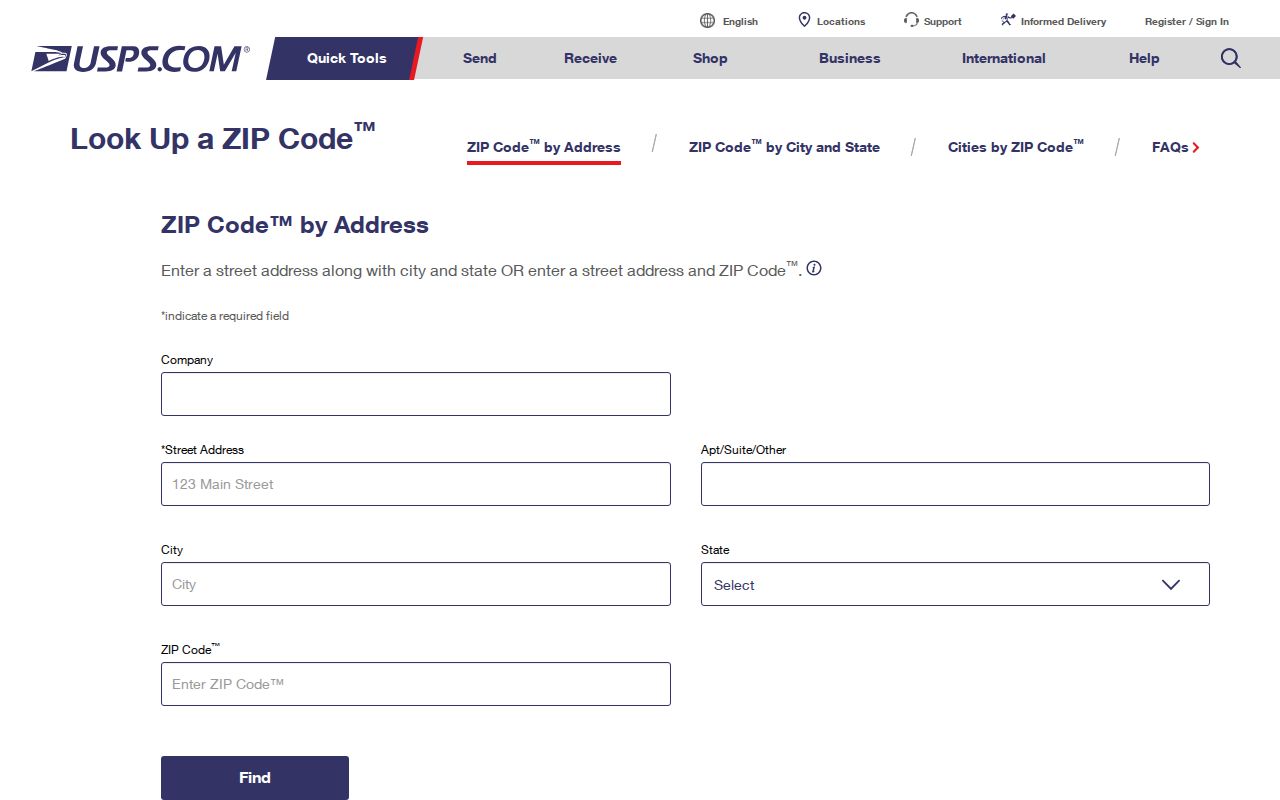
The USPS screen is the final check for delivery coding. Next, locate the address in PAGIS or the Assessor and capture parcel number, situs, legal description, and jurisdiction. This two-source method catches a common error: choosing an office from the postal city rather than the parcel’s real government.
- ZIP Code
- A USPS routing code for mail delivery areas, not a city boundary.
- ZIP+4
- The base code plus four digits that narrow delivery to a smaller segment.
- PO-box ZIP
- A code used chiefly for post-office boxes rather than normal residential polygons.
- Unique ZIP
- A code assigned to one high-volume organization or site.
- Carrier route
- A delivery path within a ZIP, which is not a public list of named residents.
Search Pulaski County ZIP Permit Records
Little Rock’s CDR Online Lookup is the clearest official portal with a real ZIP field. It searches permit applications, not a full Pulaski County resident roster. The address mode accepts a partial street address, requires a street name, and uses date boundaries with a 12-month span. Status can be In Progress, Closed, or All. An applicant may be an owner, contractor, architect, or other participant, so the result needs role checking.
| CDR field | Input | Required status | Use in a ZIP search |
|---|---|---|---|
| Street Name | Text | Yes in address mode | Narrows applications within the code |
| City / State / ZIP | Text and selections | No | Applies postal components |
| From / To | Date pair | Where displayed | Keeps the query within the allowed span |
| Application Status | In Progress, Closed, All | Yes | Controls current or past results |
| Parcel ID | Text | Yes in parcel mode | Best used after an Assessor match |
The Little Rock permit lookup displays the ZIP-capable form.

A ZIP-wide CDR result reveals applications that meet the other filters. It cannot show every property or person in that code. If the portal fails, contact Little Rock Planning and Development or send a narrow Arkansas Freedom of Information Act request for an existing address and date series. North Little Rock sends permit types to separate departments, so first confirm the city.
Trace Pulaski County ZIP Edges
County-edge codes are the strongest proof that a postal area is not a county roster. The 72002 Alexander area crosses county boundaries. The 72023 Cabot fringe also reaches Lonoke County. Western 72016 and southeastern 72046 carry postal identities that can point outside Pulaski. Even within the county, 72103 joins Little Rock and unincorporated Mabelvale-area addresses.
After a ZIP directory search narrows the area, open the Arkansas GIS Office resources for statewide reference layers. County parcel and deed records remain authoritative for ownership and land identity.
The statewide GIS screen helps reconcile an edge polygon, yet it does not replace a Pulaski County parcel card or recorded plat. When a parcel falls outside the county, switch to that county’s custodian instead of forcing a Pulaski record search.
Note: USPS does not publish a stable public neighborhood-boundary dataset, so neighborhood labels should remain descriptive rather than exact ZIP borders.
Separate Special Pulaski County ZIP Codes
The 72231 code deserves separate treatment because PAGIS describes Little Rock box or special mailing use rather than an ordinary residential polygon. Other codes can appear in agency lists without joining the 29-polygon county layer. Counting every code copied from a general internet list would inflate the apparent residential geography and blur the difference between delivery service and place.
Ask one plain question: does the code describe a mappable residential area, a box route, a unique customer, or a legacy service listing? PAGIS answers the polygon question. USPS answers one address. The sending agency can explain its own mail code. No single source should be stretched beyond that role.
Find Pulaski County Residents by ZIP
A Pulaski County ZIP directory narrows the field. It does not create a browseable list of all residents. VoterView verifies a person already known and requires first name, last name, date of birth, and county. The Assessor identifies current owners and tax-mail destinations, not all occupants. Permit results identify applicants tied to work at an address.
- Verify the exact delivery code through USPS when a complete address is available.
- Use PAGIS to confirm that the ZIP polygon intersects Pulaski County and identify likely jurisdiction.
- Open the Assessor parcel record for situs, parcel number, owner, mailing address, and legal description.
- Use Little Rock CDR only when city jurisdiction and the permit question fit its scope.
- Verify a known registrant through VoterView or request an allowed voter-data extract under county terms.
For a complete named-street chain after the area is narrowed, move to the Pulaski County street directory. It keeps the address-level parcel, deed, and permit steps distinct from ZIP geography.
Check Pulaski County ZIP Parcel Context
The Pulaski County Assessor roll ties an address to its current parcel, owner of record, owner mailing address, values, and legal description. Mailing and situs addresses can differ. That difference shows where tax mail goes, not where the owner lives. A parcel card also cannot identify renters or every household member.
The county’s 2026 Assessor app announcement concerns a personal-property assessment workflow.
The app is not a substitute for the real-estate owner and parcel search. Use the Pulaski County InteractiveGIS property portal for current parcel context, then rely on deeds and plats when legal ownership or acreage matters.
Know Pulaski County ZIP Search Limits
A ZIP search can miss a correct record because the source keys data to parcel, street, precinct, legal description, or a person’s exact identity instead. VoterView is not a ZIP browser. Its protected fields and ballot choices are not public. Assessor exports may allow geographic work after access, but the research did not confirm a public ZIP control in the portal. Do not present an unverified field as a current feature.
Every channel has a fallback. Ask Assessor staff at 201 S. Broadway, Suite 310, or call 501-340-6170 for parcel help. Use municipal planning staff or a narrow records request for permits. County Voter Registration at 401 W. Markham, South Lobby, handles registration records and the Voter Data Request Form at 501-340-8336. Historical address work belongs with Roberts Library, State Archives, and CAHC.
Keep a dated note of the source used. ZIP polygons, precincts, parcel ownership, and permit status can change. A July 2026 state GIS update to Pulaski election precinct data is a timely reminder that postal geography and election geography should never be merged into one static resident map.